Top Dholera Smart City Features: What Is Actually Built and Working
Underground power and fibre
Power and fibre optic cabling in the Activation Area run underground rather than on poles. This is the single most consequential planning choice on the list, and it is invisible once complete, which is why it rarely features in marketing.
Overhead lines are cheap to install and expensive to live with: they clutter streets, fail in storms, complicate road widening and are almost impossible to bury later without tearing up a functioning city. Deciding this at the start, on a greenfield site, is one of the few genuine advantages a new city has over an old one.
The fibre matters for the same structural reason. Every system that follows, from traffic management to utility metering to the command centre itself, depends on a data backbone being in the ground before the buildings arrive. See our Activation Area page.
The ICCC command centre in the ABCD building
The Integrated Command and Control Centre operates from the ABCD building, which was designed to LEED Gold standard. The centre is operational.
A command centre is where a planned city becomes a managed one. It is the point at which utility, traffic and civic systems are monitored together rather than by separate departments reacting separately. Whether that produces good day to day governance depends on how it is run, and that is not something anyone can promise a land buyer in advance.
What can be said plainly is that the building exists, it is in use, and it was built early rather than promised for a later phase. In a market where a great deal is described in future tense, an operational facility you can visit carries more weight than a rendering. Background sits on our Dholera explained page.
Piped gas and dual water lines
Two utility features in the Activation Area are worth separating out.
Piped gas. Distribution laid at the trunk stage rather than retrofitted street by street, which is how most Indian cities have had to do it.
Potable and recycled water, run as separate lines. This is the more interesting one. A dual network lets treated water be reused for non drinking uses instead of discharged, which matters in a coastal Gujarat location where fresh water is not abundant.
Behind those lines sits a 50 MLD water treatment plant. Together the plant and the dual distribution are the difference between a city planning for water and a city assuming it. Our water and power guide covers the numbers in full.
Roads and drainage that already exist
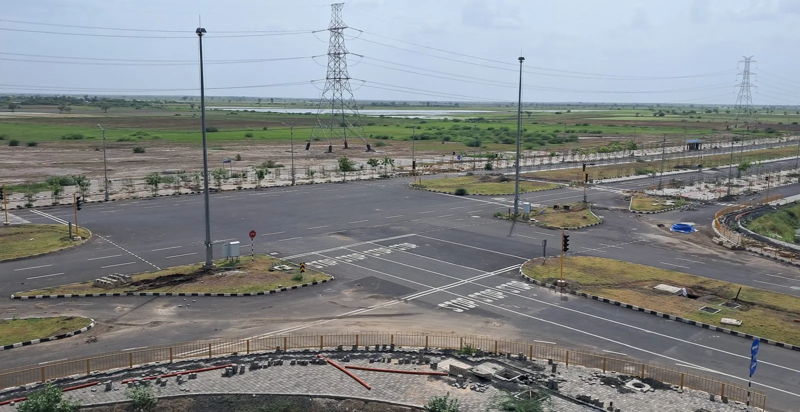
About 72 km of internal roads are built inside the Activation Area, alongside a 6.5 km stormwater canal.
Roads are the least glamorous item on any smart city list and the first thing a plot buyer should look for, because an unreachable plot is a theoretical asset. A built internal grid is also what allows service corridors, plot boundaries and Final Plot numbers to be identified on the ground rather than only on paper.
The stormwater canal deserves specific attention. Dholera sits on a flat coastal plain, and on flat coastal ground drainage is not an amenity, it is the thing that decides whether land is usable after heavy rain. A 6.5 km engineered canal built at the trunk stage is a direct answer to that. Walk both when you visit, using our site visit checklist.
How the built area fits the wider plan
Keep the proportions in mind. Dholera SIR is planned at about 920 sq km, with roughly 580 sq km developable and about 422 sq km urban, phased over around 30 years. The Activation Area is about 22.5 sq km of that.
Six town planning schemes are sanctioned. Phase 1 is TP1 at about 51 sq km plus TP2 at about 102 sq km, roughly 153 sq km together, and the Activation Area sits inside TP2. Land inside a sanctioned TP scheme is treated as non agricultural by Gujarat rule.
So the systems described above are real, and they cover a defined area. A plot elsewhere in the SIR is not automatically served by them, however often the two are discussed in the same sentence. Check which scheme a plot falls in on our TP scheme guide before assuming anything about services.
What we do not call a feature
We do not list planned systems as features. Design intent for later phases, concept drawings and technology descriptions that have no dated delivery behind them all belong in the plan, not on a list of what exists.
We also do not attach a price effect to any of these systems. Proximity to the Activation Area is a recognised price driver, alongside TP scheme status, Final Plot number, non agricultural status and closeness to the airport, expressway, central spine and rail. That is a direction, not an amount, and appreciation remains an expectation rather than a guarantee.
Before buying anywhere in the SIR, verify the project on gujrera.gujarat.gov.in, get the TP scheme and Final Plot number in writing, and pull the title chain including a 30 year encumbrance certificate. The full sequence is in our infrastructure guide.
Questions buyers actually ask
What smart city systems in Dholera are actually working?
Inside the Activation Area, about 22.5 sq km within TP scheme 2: underground power and fibre, piped gas, separate potable and recycled water lines, a 50 MLD water treatment plant, about 72 km of internal roads, a 6.5 km stormwater canal, and the ICCC command centre in the ABCD building, which is operational and was designed to LEED Gold standard.
What is the ABCD building in Dholera?
It houses the Integrated Command and Control Centre for the city, and it is operational. The building was designed to LEED Gold standard. A command centre allows utility, traffic and civic systems to be monitored together rather than department by department. It is one of the few facilities in the region a visitor can see in use rather than in a plan document.
Do these systems cover the whole of Dholera SIR?
No. They serve the Activation Area of about 22.5 sq km. Dholera SIR is planned at roughly 920 sq km, with about 580 sq km developable and around 422 sq km urban, phased over about 30 years. Six town planning schemes are sanctioned. A plot elsewhere in the SIR is not automatically connected to these networks, so confirm the scheme and Final Plot number in writing.